
Tre Cime di Lavaredo Hike: The Ultimate Guide
Tre Cime di Lavaredo is one of the most popular hikes in the Dolomites, and for a good reason! The hike takes you around the iconic three peaks of Tre Cime and offers stunning views along the way.
Although it’s a fairly easy hike, it’s best to read up on all the necessary information about the Tre Cime di Lavaredo hike before you go. No matter what time of year you attempt the hike, make sure to come prepared!
In this guide, I’ll give you all the information you need to know before hiking Tre Cime di Lavaredo, including key metrics, an overview of the route, a step-by-step guide, and packing tips. Let’s get into it!
Disclosure: This post contains a few affiliate links, which means I may receive a small commission, at no cost to you, if you make a purchase through my link.
Quick Travel Planning Tips for the Dolomites
🏨 Where to Stay: Ortisei and Cortina d’Ampezzo are two of the best bases in the Dolomites. Hotel Angelo Engel is a great option in Ortisei, while Hotel Aquila is centrally located in Cortina.
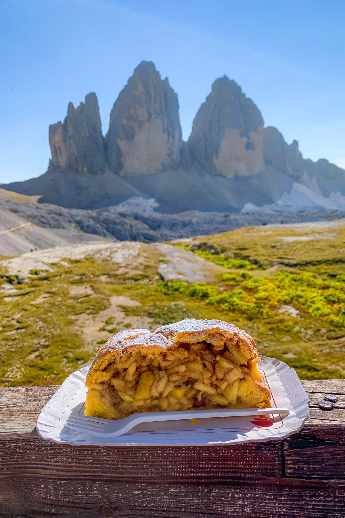
⛰️ Best Time to Visit: June to September is best for hiking and mountain scenery, while December to March is ideal for skiing in the Dolomites.
✈️ Where to Fly To: The closest major airports are Venice and Milan. Venice is the easiest option for Cortina and the eastern Dolomites, while Milan works better if you’re heading toward Val Gardena.
🚗 Getting Around: Renting a car is the easiest way to explore the Dolomites and reach trailheads and mountain passes. Use Discover Cars to compare rental options, especially if you’re visiting multiple areas.
🚌 Best Day Trips: If you don’t want to drive, join an organized Dolomites day trip from Venice that includes Cortina and Lake Braies, or a full day Dolomites tour starting from Lake Garda.
📱 Stay Connected: Use an eSIM from Airalo to stay online in the Dolomites for maps, navigation, and bookings without swapping SIM cards.
No time to read now?
Pin it for later!

Key Metrics
Tre Cime di Lavaredo Hike
Starting point: Rifugio Auronzo
Ending point: Rifugio Auronzo
Distance: 10 km
Elevation gain: 430 m
Lowest elevation: 2,171 m
Highest elevation: 2,448 m
Duration: 3-4 hours
Difficulty: Easy/moderate

Overview of the Tre Cime di Lavaredo Hike
Being one of the most famous hikes in the Dolomites, visiting Tre Cime di Lavaredo is a must when hiking in the Alps. The entire loop is around 10 km long, and since it’s a fairly easy hike, it can be completed by hikers of all levels.
Although many websites state that the hike is mostly flat, this is not the case. The first 1.8 km is pretty flat, but the rest of the hike includes lots of ups and downs. The total elevation gain is around 430 m during the whole hike, so it’s totally manageable even for beginners.
The entire loop takes 3-4 hours to complete, although this will obviously depend on your fitness level and how often you stop to take photos (hint: it will be often).
The route starts and ends at Rifugio Auronzo, a mountain hut located at the base of Tre Cime. From here, you’ll follow a well-marked trail that takes you around the base of the three peaks. The views are stunning the entire way and only get better as you make your way around the loop.
The hike can be completed in both directions, but it’s better to do it counterclockwise, as this way you will be facing the three peaks the entire time.
During the hike, you will come across three other mountain huts – Rifugio Lavaredo, Rifugio A. Locatelli (otherwise known as Dreizinnenhütte), and Malga Langalm – all of which offer great views and make for a nice break during the hike.
The best time to hike Tre Cime di Lavaredo is from June to September when the weather is most stable. It’s one of the busiest hikes in the Dolomites and can get pretty crowded during peak season, so it’s best to start your hike early in the morning to avoid the crowds.
Not only will you have the trail mostly to yourself, but you’ll also get to experience the magical light that the Dolomites are so famous for.
Below, I will share a step-by-step guide on how to complete the Tre Cime di Lavaredo hike so you can plan your trip and come prepared.

Getting to the Tre Cime di Lavaredo Trailhead (Rifugio Auronzo)
The starting and ending point of the Tre Cime di Lavaredo hike is Rifugio Auronzo. You have three options to get to Rifugio Auronzo: you can either hike up from Lake Antorno (which is one of the most beautiful lakes in the Dolomites), take a public bus, or drive up.
I will share everything you need to know about these three options below so you can choose the one that’s best for you!
Option 1: Hiking from Lake Antorno to Rifugio Auronzo
If you have a very strict budget, hiking up to Rifugio Auronzo from Lake Antorno is your best option as it’s completely free. Also, if you’re traveling in the off-season when the toll road is not open (more about this later), this is your only option to get to the three peaks.
There is a car park near Lake Antorno, right next to Chalet Lago Antorno, where you can leave your car for the day. To start the hike, you need to find the trailhead for trail nr. 101, which starts on the right side of the toll gate.
It takes around 1.5-2 hours to reach Rifugio Auronzo. Be prepared for a very steep hike as you need to tackle around 461 m of elevation gain during the 4 km long hike.
I would only recommend this option if you are an experienced hiker, otherwise, go for the bus or the drive. Keep in mind that after this hike, you still need to complete the Tre Cime di Lavaredo loop hike and then hike back down to Lake Antorno, which makes for a very long day.

Option 2: Taking a bus to Rifugio Auronzo
If you don’t have your own car and you want to skip the additional hike to Rifugio Auronzo, you can take advantage of the public bus nr. 444 that goes directly to the mountain hut.
The bus departs from Dobbiaco, and it has 6 stops along the way, including Dürrensee, Lake Misurina, and Lake Antorno, before arriving at Rifugio Auronzo.
The bus ride takes around 45 minutes one way, and the prices go as follows:
- One-way ticket: €10 for adults, €5 for children (free under the age of 14 when accompanied by adults), €5 for dogs
- Round-trip ticket: €16 for adults, €9 for children (free under the age of 14 when accompanied by adults), €9 for dogs
If you’re traveling in high season, it’s strongly recommended to book your tickets online in advance. Otherwise, the unsold tickets can be bought at the bus station in Dobbiaco, but there is no guarantee that there will be any available.
In case you’re staying in Cortina d’Ampezzo, you first have to take bus nr. 445 and change to bus nr. 444 at Dürrensee. This will add an additional 45 minutes to your journey.
Buses typically operate from early June to early October, and they usually run every 30-60 minutes. The first one leaves around 7:30 am from Dobbiaco, while the last one normally comes back around 6 pm from Rifugio Auronzo.
When planning your route, it’s best to check the schedule in advance, as it can change from year to year.

Option 3: Driving up to Rifugio Auronzo
If you have your own car, driving to Rifugio Auronzo is the best option as it’s by far the most convenient. I would strongly recommend renting a car when visiting the Dolomites anyway, as it gives you a lot more flexibility, and there are just so many incredible places to explore.
However, there is only one road that leads to the mountain hut, and it’s a toll road. To drive up, you now have to reserve a parking spot in advance. Without a valid reservation, access to the road is not allowed.
The toll price is €40 for cars and €26 for motorcycles.
All tickets are valid for 12 hours from your selected entry time. You don’t need to arrive exactly at the start of your time slot, but once the 12 hours are up, you must leave the parking lot. If you stay longer, you’ll have to pay a penalty.
The road is usually open from early June to late October, weather permitting.
Keep in mind that the road is very narrow, and it can be quite crowded during peak season. Since parking is now limited and managed through time slot reservations, spots can sell out quickly, especially in summer, so booking as early as possible is highly recommended.
Driving time to Rifugio Auronzo goes as follows:
- from Lake Antorno: 13 minutes, 5.5 km
- from Lake Misurina: 17 minutes, 7.5 km
- from Dobbiaco: 40 minutes, 27 km
- from Cortina d’Ampezzo: 40 minutes, 22 km

Step-by-Step Guide to Hiking Tre Cime di Lavaredo
1. Hiking from Rifugio Auronzo to Rifugio Lavaredo
Distance: 1.8 km, 20-30 minutes
The Tre Cime di Lavaredo loop trail starts at Rifugio Auronzo, located at an altitude of 2,340 meters. While you can complete the loop in any direction, it’s best to do it in a counterclockwise direction.
You simply can’t miss the trailhead as there is only one road on the right (eastern) side of the hut and it’s marked as trail nr. 101.
From Rifugio Auronzo, the first part of the trail is pretty flat and easy, as it follows an old military road. During the hike, you will get to enjoy the panoramic view over the valley and the surrounding mountains on your right side, while you will see Tre Cime on your left side.
Shortly, you will pass by a little chapel, and not long after that, you will arrive at Rifugio Lavaredo.
This mountain hut is situated 2,344 m above sea level, which means there is almost no elevation gain on this section of the hike. The path is roughly 1.8 km long, so it can be completed in around 20-30 minutes.
In case you need a little break, you can buy drinks and snacks at Rifugio Lavaredo (they only accept cash). They are also open for an overnight stay, but for that purpose, I would rather recommend Dreizinnenhütte.


Views along the hike 
Rifugio Lavaredo
2. Hiking from Rifugio Lavaredo to Forcella Lavaredo
Distance: 0.8 km, 15-20 minutes
From Rifugio Lavaredo, the trail splits into two different paths. Both paths will lead you to Forcella Lavaredo, which is the highest point on the entire Tre Cime di Lavaredo hike. Located at 2,448 m above sea level, this viewpoint provides a jaw-dropping view over the valley and the mountains.
If you’re in a hurry, choose the upper path as it leads directly to the viewpoint. It’s also the shorter route of the two, but in exchange, it’s steeper as well.
The lower part of the trail is a bit longer, but it’s also the easier option as it’s less steep. This path continues a bit further in the valley before turning uphill to the viewpoint.
You can also take a little detour in the valley, where you can find a beautiful little lake right before the trail starts to climb uphill.
The entire hike from Rifugio Lavaredo to Forcella Lavaredo is only 0.8 km long with around 100 meters of elevation gain, so it should only take you around 15-20 minutes.


3. Hiking from Forcella Lavaredo to Dreizinnenhutte
Distance: 2 km, 30-45 minutes
After soaking in the views at Forcella Lavaredo, it’s time to head to one of the most famous mountain huts in the Dolomites.
Located at 2,438 m above sea level, Dreizinnenhütte, otherwise known as Rifugio A. Locatelli, offers one of the most incredible views over the iconic three peaks.
From Forcella Lavaredo, you can already see Dreizinnenhütte in the distance, so you simply can’t miss the road.
There are actually two paths leading up to the mountain hut, running parallel to each other. The lower path is wider and more comfortable, so it’s a better choice for beginner hikers. The upper path, on the other hand, is a little bit more challenging, but it’s considerably quieter than the lower one.
The trail starts with a little descent before it continues on a flat path through the valley. Then you will start to climb uphill until you reach Dreizinnenhütte. This last section is a bit steep, but it’s not too difficult.
This section is roughly 2 km, and depending on your fitness level, it can be completed in 30-45 minutes.
If you’re in a hurry and just want to complete the loop hike, you can actually skip the short climb up to the mountain hut and just continue on trail nr. 102 that leads down to the valley. However, this is hands down the best part of the hike, so I would strongly advise against skipping it!


Dreizinnenhütte makes an amazing lunch stop during the Tre Cime di Lavaredo hike. They have a large sun terrace where you can enjoy the incredible views over the three peaks while savoring some delicious traditional dishes from the Dolomites.
Just make sure to have cash with you, as they don’t accept credit cards.

If you have a little extra time, it’s worth exploring the nearby area as well. You can find a few WW1 bunkers and tunnels, amazing caves, and even two lakes (Laghi dei Piani) within a short distance from Dreizinnenhütte.
There are two via ferrata routes starting here as well, so if you’re keen on adding more adventure to the Tre Cime di Lavaredo hike, you can opt for one of the routes too.
The most famous caves are located right above the mountain hut, and you can easily reach them with a 5-10 minute steep uphill hike. The caves provide a perfect frame for the peaks, so make sure to take some photos here!


You can also stay at Dreizinnenhütte overnight if you want to spend more time in the area or if you would like to see the golden hour at sunset or sunrise in the mountains.
They offer dormitory-style rooms or beds in smaller rooms, and you can also opt for breakfast or half-board. It’s important to note that they usually receive tens of thousands of inquiries each season and the hut is fully booked months in advance, especially during the peak summer season.
So if you’re planning to stay here overnight, make sure to book your spot well in advance!
4. Hiking from Dreizinnenhutte to Malga Langalm
Distance: 3.3 km, 1.5 hours
To continue the Tre Cime di Lavaredo loop hike, you need to follow path nr. 102 from Dreizinnenhütte, which leads you down to the valley.
First, you need to descend almost 250 m from Dreizinnenhütte, so this section can be a bit challenging for your knees. The path is quite steep and rocky in places, but it’s still manageable.


The hardest part of the Tre Cime di Lavaredo hike starts after arriving at the bottom of the valley, as you will need to hike up on a very steep and long road.
Although the elevation gain is only around 100 m, this part feels like an eternity (at least it did for me). Once you arrive at the top, you will already see Malga Langalm in the distance.
You need to continue on trail nr. 105, and after crisscrossing on the creek, you will soon reach the guesthouse.
Although they don’t offer accommodation, they do have a great restaurant, so if you haven’t eaten at Dreizinnenhütte, it’s a great place to have a quick meal. Similar to the other mountain huts, they accept cash only.


5. Hiking from Malga Langalm to Rifugio Auronzo
Distance: 2.1 km, 30-45 minutes
The last part of the Tre Cime di Lavaredo hike is quite easy, there is only a small incline towards Forcella Col di Mezzo. After you tackle that, it’s a relatively flat hike that takes you back to the parking lot.
It takes around 30-45 minutes to get back to the parking lot at Rifugio Auronzo from Malga Langalm, and you can enjoy a stunning view of the Cadini di Misurina peaks in the distance.

Map for the Tre Cime Loop Hike
Below you can find a customized map that includes the most important checkpoints during the Tre Cime di Lavaredo hike, as well as some important locations such as parking spots and mountain huts.
How to use this map: This map is fully interactive, so you can move around, zoom in/zoom out, and click on the icons. If you want to see a larger map, click on the bracket in the upper right corner. To see more details and the different layers, click on the tab in the upper left corner. If you want to save it for later, click on the star icon next to the name of the map. Then simply open Google Maps either on your desktop or phone, go to ‘Saved’/’Maps’, and open the map whenever you need it.
Where to Stay near Tre Cime di Lavaredo
Mountain huts
If you want to stay as close as possible to the three peaks, obviously, the most convenient option is to stay at one of the mountain huts along the way.
As for now, you can choose from these three:
- Rifugio Auronzo
- Rifugio Lavaredo
- Rifugio A. Locatelli/Dreizinnenhütte
Since the Tre Cime hike is one of the most popular hikes in the Dolomites, the mountain huts are usually fully booked months in advance. So if you want to stay here, I recommend booking your spot well in advance!
Unless you don’t want to bring your own food, it’s best to opt for the half board option, as you won’t find any other restaurants in the area.
Dobbiaco
If you would rather stay in a town, one of the most convenient options would be Dobbiaco. It’s a 40-minute drive from Tre Cime, and it’s also connected to the three peaks via a direct bus route.
Dobbiaco is a great base to explore the area, and it has a lot of nice hotels, restaurants, and cafes. It’s also close to Lago di Braies, one of the most famous lakes in the Dolomites.
Here are my top picks for staying in Dobbiaco.
- Luxury: Skyview Chalets am Camping Toblacher See
- Mid-range: Hotel Rosengarten
- Budget: Guesthouse Rosengarten
Cortina d’Ampezzo
Cortina d’Ampezzo is another great option as it’s also just a 40-minute drive from Tre Cime di Lavaredo.
Surrounded by the majestic peaks of the Dolomites, Cortina d’Ampezzo is one of the most popular mountain towns in Italy. It’s one of the best places to stay in the Dolomites if you want to explore the area, and it has a lot of nice hotels, restaurants, cafes, and high-end shops.
If you’re looking for a more upscale experience, Cortina is definitely the place to be! Here are some of the best hotels in Cortina for different budgets.
- Luxury: Grand Hotel Savoia Cortina d’Ampezzo
- Mid-range: HOTEL de LEN
- Budget: Hotel Meuble Oasi

Other Things to Do near Tre Cime di Lavaredo
Although the Tre Cime hike is definitely the highlight of the area, there are a few other things to do near Tre Cime di Lavaredo that are definitely worth checking out.
- Cadini di Misurina: A steep 30-45 minute hike from Rifugio Auronzo leads to this famous viewpoint with some of the most stunning views in the Dolomites. If you want to know how to get to this epic viewpoint, read my step-by-step guide about the Cadini di Misurina hike!
- Lago Antorno: This scenic lake, bordered by larch forests, offers breathtaking views of Tre Cime and Cadini di Misurina. It’s a great place to rest before hiking, with a short 20-minute walk around the lake for a warm-up.
- Cortina d’Ampezzo: Surrounded by mountains, this charming town is perfect for exploring on foot. Enjoy great restaurants, cafes, and luxury boutiques, or take a cable car up to Rifugio Faloria for panoramic views.
- Lago di Misurina: Just a 15-minute drive from Tre Cime, this serene lake is ideal for relaxing after hiking. With restaurants and cafes around the lake, it’s a great spot to unwind with a meal or coffee.
- Lago di Sorapis: Known for its stunning turquoise waters, this 12 km out-and-back hike is one of the most popular things to do in the Dolomites. Though challenging, the views at the top make the effort worthwhile.
- Lago di Landro: Also called Dürrensee, this large lake offers views of the Cristallo Group and Ampezzo Dolomites. It’s a great stop to stretch your legs when driving between Dobbiaco and Tre Cime, with a restaurant nearby for a meal with a view.

Cadini di Misurina 
Lago di Sorapis


Thanks for sharing your experience on hiking Tre Chime di Lavaredo. This is on our bucket list, we will be in Cortina on the 28th of May this year, but it seems that the toll both only opens on the 1st of June, so we were thinking of renting some ebikes at Tre Cime Service (Lake Autorno) and riding up to Rifugio Auronzo. Did you consider this option instead of walking the road up to the Rifugio Auronzo?
Yes, I think riding up with e-bikes is a lot easier than hiking up, so I would definitely look into this if it’s an option for you! Also, I think it’s worth asking around the locals when you get to your accommodation about the road openings, who knows, maybe they open up a few days earlier than scheduled 🙂